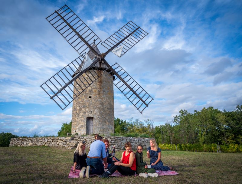
This walk, starting in Montagne, offers a magnificent view from the Butte de Calon, where you can watch the windmills and the winegrowing landscape.
The stages
Opposite the church, turn right onto the D244.
At the ‘give way’ sign, turn right.
At the end of the road, turn left at the bend. Continue along this road until you reach the next crossroads.
At the crossroads, turn right (signposted ‘Château la Bergère’).
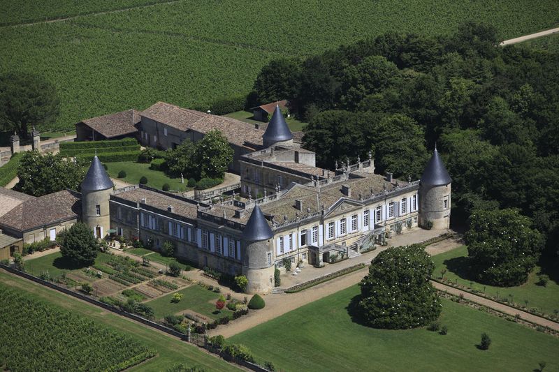
Turn right at the next junction. Stay on this ‘chemin de la croix de mission’ until you reach Saint-Georges church (pass in front of Ch. la Bergère).
Turn right and drive past the Ch. Saint-Georges. Turn left and continue straight ahead. You are once again entering the village of Montagne. Continue straight ahead on the lane that runs behind the church of Saint-Martin (bending slightly to the left). Continue to the next crossroads.
Take the first right onto the road that leads up to a place called ‘Arriail’. Continue along this road until you reach the D122 road above, towards Ch. Calon.
At the main road, turn left towards Ch. Calon and continue until you reach the next turning on the right.
Turn right towards Ch. Maison Neuve Coudroy.
Then take the first path rising to the left. Continue to the end and turn left (yellow-green markers).
Walk a few metres and take the first path to the right.
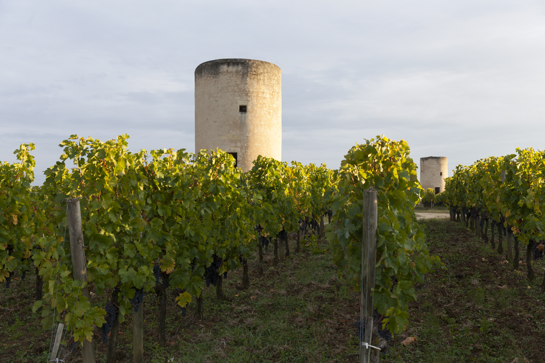
You will arrive at the Calon mills site. Join the road opposite. At the road, turn right and continue as far as the 3rd mill. Take the path on the right, signposted ‘boucle des moulins’. Continue downhill until you reach a tarmac road (green signpost).
At the road, turn right and continue to the next crossroads.
At the main road, turn right.
Turn left onto the track that leads downhill and that you took earlier. At the bottom, cross the road to continue straight ahead.
Continue downhill on the left and go straight on between the trees and vines.
At the end, continue up the path to the right
At the top, turn left and continue to the next junction, at the entrance to the hamlet.
At the junction, continue to the right until you reach the next crossroads. Cross the main road and continue along the road almost opposite.
Continue along this road. (You can shorten the route here by taking the path to the right and continuing straight on until you reach the junction with the D244, where you turn right into the village).
Continue to the left.
Continue to the right to enter the wood.
Continue straight on until you reach the main road. At the crossroads, continue straight ahead. At the next crossroads (at the stop sign + sign for ‘Montagne’) turn right. Take the first track on the left. Go past the Ch. des Tours. At the end, turn right and go around the building to the left to join the D244. Turn left to return to your starting point.
Grand Saint-Emilionnais Tourist Office
Le Doyenné - Place des Créneaux
33330 SAINT-EMILION
![]()
![]()