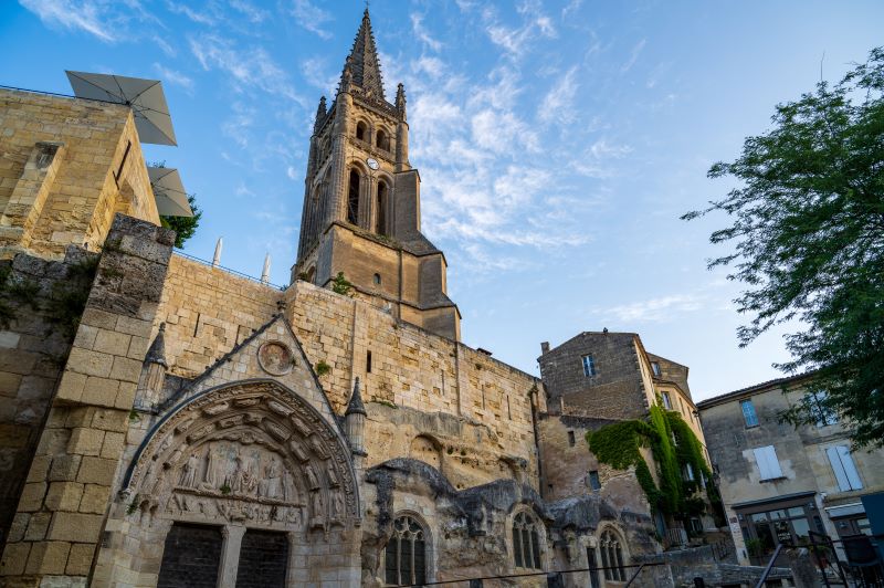
Discover Puisseguin on this medieval walk of around fifteen kilometres. This village occupied a strategic position during the 100 Years' War. Not far from the village, the hamlet of Monbadon is also a major heritage site, with its Romanesque church and feudal castle.
The stages
From the church square, the church in your back, the pharmacy on your right take direction "place Fressineau" on your left (towards “rue du Mayne“). Pass by ”la société des eaux” on zour right. At the end of the road, continue to the left. At the first junction, continue straight ahead until you reach the D130 crossroads.
At the stop sign, turn left, then right (“route du Chais”). Continue straight ahead up to the entrance of the hamlet. Turn right and keep walking down to the crossroads. Turn right and stay on the left hand side of the main path ("Baisse" locality).
Turn right in the path in front of the two water points on your left (“route du Cros”). Turn left in the first path and stay on it.
Turn right and continue up to the "rue de Guillotin”. At the junction with the D130 road, turn left then immediately right. Carry on straight ahead up to the D17 road. Turn right and walk along the main road. (If you want to shorten the walk here, continue straight ahead to return to the starting point). Turn left in the path just before the town hall, right after Ch. Beauséjour (right-hand side). Continue straight ahead up to Ch. Bel-Air.
Continue on your right and stay on this tarred road until the next junction, at the end of "rue du Barrail". At the end of the path, turn left. At the junction, continue on the left and keep walking up to the next junction (D244).
Turn right. Walk along the main road, then turn left the next road (rue de Durand). Continue on this way until you reach the end of the road (yellow and green signs). Take the 2nd road on the left (3rd sign), and continue on that path that goes through the vines up to the end of the plot.
Turn left and continue straight ahead until you reach a dirt path. When the path deviates to the left, leave it and turn right to walk through the vines. Carry on straight ahead to reach the road. Cross it and continue straight ahead up to the next junction.
Turn right and follow the wooden sign “circuit médieval”. Juste before the buildings a small path goes down on your left (hairpin turn). Turn left and continue straight ahead. The path deviates to the right and leads you to a pond.
Turn right at the pond and carry straight on. At the next green sign turn slightly left and cross a piece of woodland until you reach a tarred path (green signs). Turn right then left (signs) into “rue de la reine Margot”). Turn right in the next path, then turn left at the end of it (“impasse de la Plaigne”).
Stay on this path, which turns into a dirt path, go ahead in direction of the trees in front of you. After the last winefield continue styraight ahead (the path is slightly going down and turning right) and leads you to a tarred road. Here, turn left.
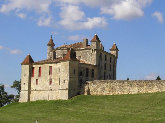
Stay on this path, then turn right at the green sign. Continue straight until the end. Then turn left and carry on (chemin de la Dodogne) up to the next junction where you’ll find Ch. des Faures. At the end of the path, continue on the right. The path named "route de Faure" will lead you to the D21 road. From there, you can admire the valley and the Château de Monbadon.
At the crossroads, turn right towards "Monbadon, commune de Puisseguin". Take the first street on the right towards “Église romane de Monbadon”. Pass the church and the cemetery and continue straight ahead on Gabriel Taix Road . Turn left in the next path that goes through the woodland and joins the D21 road. Turn left. Leave that road to take the first path on your right. At the end of it, turn left and stay on this path, at the junction continue straight on Via Pompéianus/Rte de l’Anglais until you reach the D123-E7. At the stop sign turn right in direction of Puisseguin.
Arrived in Puisseguin, turn left to make your way back to the center of the village, your starting point.
Grand Saint-Emilionnais Tourist Office
Le Doyenné - Place des Créneaux
33330 SAINT-EMILION
![]()
![]()